Posts

Day 1 to and in Vancouver

Image
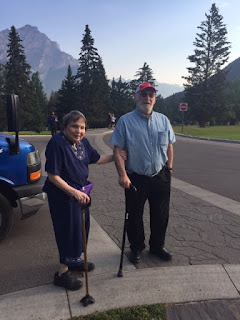
 Note: the dates and times are fictitious in order to make the blog sequential. We took an August 14, 3am Uber to Dulles and about 20 hours later, this is Ann in Jack Poole Plaza near the Vancouver Convention Center. It was the site of the completion of the carrying the torch for the 2010 Olympic games. Lots of pricy yachts in Vancouver Harbour. Across the harbour is North Vancouver with mountains in the background. Also, max temp in Vancouver International Airport (~49N and near a body of water that is in the 50sF) was 80F. Max temp at National Airport (~39N) was 76F.

Day 2 Vancouver to Kamloops

Image
  It is about 200 miles from Vancouver to Kamloops (both British Columbia). It took about  8 or 9 hours by train (Rocky Mountaineer) because of rail crossing and tight turns and steep grades. But it was a relaxing trip (e.g., nice seats, complimentary beverages). August 16 max temp at National Airport was 82F. Max temp in Kamloops (~59N) was 91F. There was a lot to see on the way.  First image was taken about 20 miles east of Vancouver where the train crossed from the south shore to the north shore of the Frazier River. It shows a barge pulling (from east to west, downstream) a load of logs.  Probably no big deal to people who live in the NW USA but I'd never seen that before. It is a really old technology that is still cost effective and obviously used.  The second image is of Mount Baker. I used a photo taken by Erna Louisa on flicker  because it was much better than any I could have taken and because her picture was also taken in August (2008). Mount Baker is about 40 miles sout

Day 3 Kamloops to Jasper

Image
 Max 17 August temp in Jasper (~53N and 5000' was 81F). Max at National Airport was 85F. We follow the North Thompson River almost all the way to Jasper.  First image shows the river as we crossed it at one point. The aqua color is partly due to fine dust formed by glaciers at the source of the river and partly due to silt it picked up on the way.  If there were no silt, it would be more blue. One of the sad things along this trip was how much of the Thompson plateau had been marred by a massive fire about 20 years earlier. The fire was a linear only burning one side of a hill but it went on for what seems like 10 miles or so.  Second image shows the current situation where some of the burnt trees are still standing and the vegetation is slowly healing. The plateau, near where the fire was, only gets about 10-15" of rain. Click to enlarge so you can see the burn problem. There were some magnificent sights along the way. One was a waterfall called pyramid falls. Image 3 shows t

Jasper Alberta

Image
Again it was hot but I'm discontinuing the temperature reports I did earlier. The hot weather was clear, very clear leading to some impressive views: The first image is a Medicine Lake. This lake famously disappears in October as the runoff from the surrounding area ends and the lake water goes into underground channels. The disappearance of the lake made the Indians call it 'bad medicine lake", but as the cause became known, it was rebranded.    The next image is of me at Maligne Lake. It was called that because the European discover had a number of disasters in his discovery.  The part of the lake you can see is called the "Hall of the Gods". A large snowfield, under which is probably a glacier, is on top of the mountains behind me and to my right. Note the 'no cloud' conditions.  We could still see the moon at 12:15pm.  The next image is up close of a pine tree that has been badly infected by the Rocky Mountain Bark Beatle - this critter is causing inc

More Glaciers

Image
We have experienced a lot  of Glacier views. It made sense to me to group them together rather than use dates as an organizing principal.     (I'm not including the dates - but they are all in mid August).  Perhaps my favorite glacier view/experience was at the Athabasca Glacier. This is one of many outgrowths of the Columbia Icefields.  The Athabasca Glacier goes down to about 6200'  (the day we were there). The images, the seond and third are of me pretending to drive the glacier mobile The first is me walking on the glacier.    Elevation was about 6300' where I was.  It was in the upper 50sF on the glacier that day.   Another great glacier view is also a lake view and surely is one of the best in the world.  It is from Fairmont Chateau at Lake Louise. The image is from the hotel website.    Another image, this one from "Destinationlesstravel" is of another lake near Lake Louise which has a glacier in the background.   We were there on the sabbath and the only i

More Lakes

Image
 Canada has really beautiful lakes. I have noted previously the ones near Jasper. But there are more. Much more. The first image is of me near Lake Minnewanka. Some of the Sioux sub-tribe moved to Canada in the 1800s with the permission of the Black Hawk tribe.  This lake was once a series of five natural lakes along the Cascade River (that is Cascade Mountain in the background).  A dam, built to generate hydro-electric power, raised the level of these lakes by over 30'. The second image is Two Jacks lake which is a natural lake with Mount Rundle in the background.  The lake is along the Bow River.  The river is called that because the Indian preferred their bows to be made of birch growing along this river.  Just upriver from the previous image is Bow Falls. Ann is in the image. Marilyn Monroe visited Bow Falls in 1954 to make the movie "River of No Return" with Robert Mitchum.  Marilyn goes over the falls in that movie (see poster).    There was some debate after this m

More Mountains

Image
  Lots and Lots of Mountains in Alberta. One image I liked includes a bus we took for some of the tour.     It also has Cascade Mountain in the background and both Ann  and I.  This was at the present Canadian Parks HQ in Banff (originally built as a sanitarium for TB patients). Banff is an odd name but the founder of the city was from Banff in Scotland and took the name from there. I had Mount Edith Cavelle in this blog earlier. But that was a view from the west. This is a view from the east. It was taken at about 5000' in elevation. The sign points to the mountain and I thought the sign was interesting (click on image to enlarge). The next image is of me in front of a hotel with Cascade Mountain in the background. This hotel was once the HQ of the Canadian RR with living quarters and offices for employees. It was made of wood and in 1928 it burned down. It was rebuilt into a hotel. It has room for over 700 guests and requires a staff of over 1000 (click to enlarge).    Ann is in